There are no words to describe the devastation of the California fires specifically in Altadena, Palisades, and on Pacific Coast Highway in Malibu. I don't feel the need to write too much, but rather to let the photographs speak for themselves and to highlight two interviews with an Altadena resident whose family home burned down and a Cal Fire Public Information Officer.

The Eaton Canyon Fire

Debris and yellow caution tape at an outdoor disaster scene.

“Honestly, I feel like most of the media is talking about Palisades, and I feel like we also need to be talking about the Eaton canyon fire. Both communities have been impacted by it majorly. A lot of people lost their homes in both areas. I just feel like a lot of people should know what’s going on over here too. Me, personally, I lost my home. I’m sad for me, and I know at least 20 people of my friends and family who lost their homes too. It’s just crazy hearing stories and the new stories of different friends and family calling me every day saying that they lost their home.


We lost everything so we’re starting brand new. We’re in shock, but we’re still trying to keep going forward. We have an Airbnb now so that’s what we’re trying to do for the next couple of months so we can figure out something to do.” 


-CC on January 10, 2025


Row of burned and damaged vehicles lined up on a road after destruction.
Close-up shots of a severely burned and charred vehicle interior.
Fallen power lines and damaged utility poles along a debris-strewn street.
Palm trees stand against a sky near burned ruins of a structure.
Close-up texture of dried brown leaves and natural debris.
Yellow caution tape stretched across concrete barriers with warning signs.


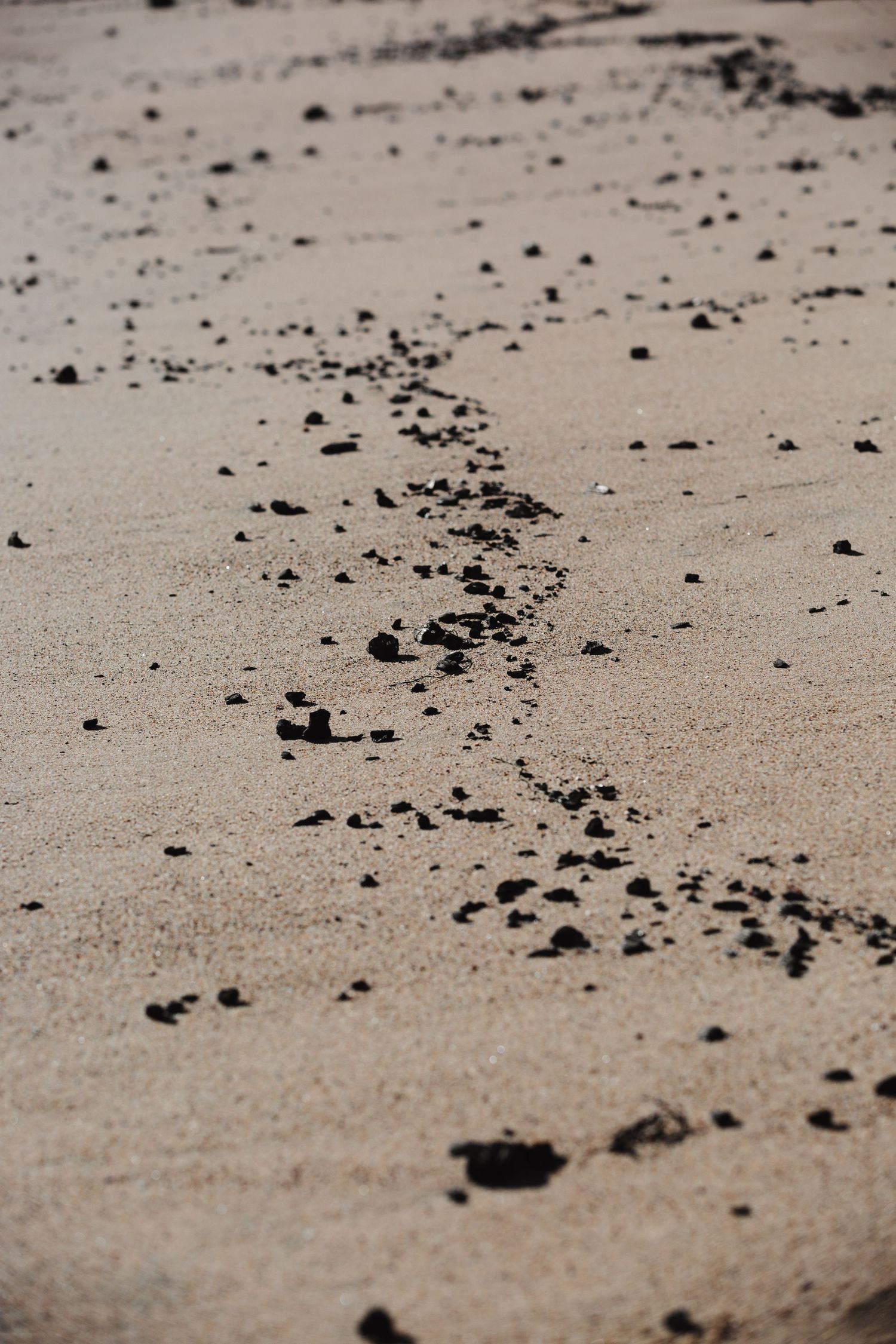
Pacific Coast Highway-Malibu


In partnership with Not On Our Watch (NOOW),  Lui Enrique, and I in were granted access under Cal Fire to photograph restricted areas of PCH and Palisades.

Black and white beach landscape with tire tracks in the sand.
Numbered panels on a damaged wall or fence structure in black and white.

“Containment is a really hard thing to describe. We have to have a complete black line for multiple days in a row for us to consider it being contained for a percentage. Until we have actual boots on the ground, a hardline put in around that section of the fire, we will not say it’s contained. Evacuation orders are on Fire.Ca.gov and LAFD's page. There's also a really good app called, Watch Duty. I highly encourage people to download that app. It's updated pretty much in real time.


The two major impacts for every fire are terrain and just the weather. The Santa Ana winds are really big deal in this area and really contributed to how crazy this was for a few days. Every single day in our briefings we’re learning about all this to try and have as much information as possible to properly fight that.”


-Devin Terrill, Cal Fire Public Information Officer on January 11, 2025

Close-up view of small black rocks scattered across beige sand.
Palm tree silhouettes stand tall against a clear blue sky.
Coastal view of damaged structures and ruins along an oceanfront with blue water.
Palm tree lined coastal road with parked cars and ocean views.

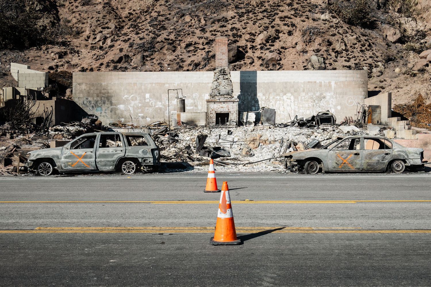
Crashed vehicle abandoned most likely in attempt to escape the fire.

Burned out cars line a street after devastating wildfire damage.
Charred ruins of a coastal property with a lone chimney stack and palm tree standing against the ocean.
Black and white image of extensive fire damage showing burned debris and structural remains.
Aerial view of destroyed coastal neighborhood with yellow caution tape in foreground.
Damaged and burned trees line roadway after wildfire destruction.
Silhouette of a gnarled tree against sunset sky with fire-damaged landscape below.
Close-up of scorched tree bark with sunlight creating golden patterns through the burnt texture.
Stark silhouettes of bare tree branches against a gray winter sky.
Partially destroyed white building with surviving trees and structural elements against blue sky.
Person in yellow jacket sitting near cliff edge overlooking ocean view.
Burned cars parked along road with orange traffic cones and rocky wall.
Sequence of black and white photos showing progressive destruction of building framework structure.
Black and white aerial photograph showing extensive urban damage patterns and destruction.

Sunset Blvd.


Abandoned cars were bulldozed aside to allow civilians and personnel to pass through.

Panoramic view of suburban street with burned trees and parked vehicles.
Street view showing aftermath of wildfire with burned vehicles and debris.
Row of parked cars in parking lot near forested area.

Palisades


Neighborhood and downtown

Interior vehicle view showing destruction and debris through windshield.
Row of destroyed buildings with exposed walls and structural damage along an empty urban street.
Damaged and burned buildings line a devastated city street with debris scattered everywhere.
Burned interior of building with arched columns showing extensive fire damage.
Empty street lined with damaged buildings and street signs showing extensive destruction.
Aerial view of widespread destruction across an urban area with collapsed structures and debris.
Destroyed storefronts and commercial buildings with debris scattered along the sidewalk.

Here are some ways to get involved


Volunteer & give to:

@ladreamcenter

@laworksnow

@samaritanspurse


Other resources:

@mutualaidla


Other ways to help:

-If you know of someone who lives in the affected areas, check up on them and see if they need help. There are still missing people

-Download the “Watch Duty” app to stay up to date on the fires

-Pray

Please fill out the form to get in contact